


Voting District 50170, Imperial County, California
About
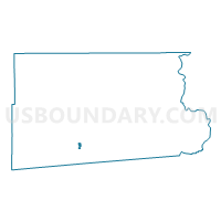
Outline

Summary
| Unique Area Identifier | 531096 |
| Name | Voting District 50170 |
| County | Imperial County |
| State | California |
| Area (square miles) | 1.70 |
| Land Area (square miles) | 1.69 |
| Water Area (square miles) | 0.01 |
| % of Land Area | 99.51 |
| % of Water Area | 0.49 |
| Latitude of the Internal Point | 32.78928570 |
| Longtitude of the Internal Point | -115.54301630 |
Maps


Graphs
Select a template below for downloading or customizing gragh for Voting District 50170, Imperial County, California


Neighbors
Neighoring Voting District (by Name) Neighboring Voting District on the Map
- Voting District 20025, Imperial County, CA
- Voting District 20032, Imperial County, CA
- Voting District 30065, Imperial County, CA
- Voting District 50175, Imperial County, CA
- Voting District 50180, Imperial County, CA
- Voting District 50225, Imperial County, CA
- Voting District 50240, Imperial County, CA
- Voting District 50245, Imperial County, CA
Top 10 Neighboring County Subdivision (by Population) Neighboring County Subdivision on the Map
Top 10 Neighboring Place (by Population) Neighboring Place on the Map
Top 10 Neighboring Elementary School District (by Population) Neighboring Elementary School District on the Map
- El Centro Elementary School District, CA (38,593)
- McCabe Union Elementary School District, CA (6,758)
- Meadows Union Elementary School District, CA (2,167)
Top 10 Neighboring Secondary School District (by Population) Neighboring Secondary School District on the Map
Top 10 Neighboring State Legislative District Lower Chamber (by Population) Neighboring State Legislative District Lower Chamber on the Map
Top 10 Neighboring State Legislative District Upper Chamber (by Population) Neighboring State Legislative District Upper Chamber on the Map
Top 10 Neighboring 111th Congressional District (by Population) Neighboring 111th Congressional District on the Map
Top 10 Neighboring Census Tract (by Population) Neighboring Census Tract on the Map
- Census Tract 113, Imperial County, CA (10,460)
- Census Tract 115, Imperial County, CA (6,232)
- Census Tract 112.01, Imperial County, CA (6,043)
- Census Tract 118.03, Imperial County, CA (5,937)
- Census Tract 117, Imperial County, CA (4,797)
- Census Tract 114, Imperial County, CA (4,580)